Verified insights & easy-to-understand frameworks on the space market, and space enabled solutions. This includes market reports on technologies, applications, and use cases across various sectors as well as easy navigation to the marketplace based around common keywords.
What are Space-enabled Solutions?
These explanatory guides show how the three major technologies, Earth Observation, Satellite Position, Navigation and Timing, and Satellite Communications work, and what considerations you need to know to begin using them
Satellite Communications
Essential guide to satellite communications for city planners and municipalities. Learn how SatCom enables connectivity in remote areas and disaster response scenarios.

Earth Observation
Comprehensive overview of Earth Observation technologies and their applications in urban planning, environmental monitoring, and climate adaptation strategies.
Satellite PNT
Position, Navigation & Timing
Understanding satellite-based positioning, navigation, and timing services for smart city applications, transportation, and emergency services coordination.
Find solutions for
Case Studies
Space-enabled Solutions have been used by cities across Europe for many different applications. Below you will find some of these success stories of projects, collected by EURISY
 Source · Eurisy
Amsterdam
Bridge Monitoring
Uses InSAR satellite data to monitor bridge and infrastructure stability with millimeter-level precision.
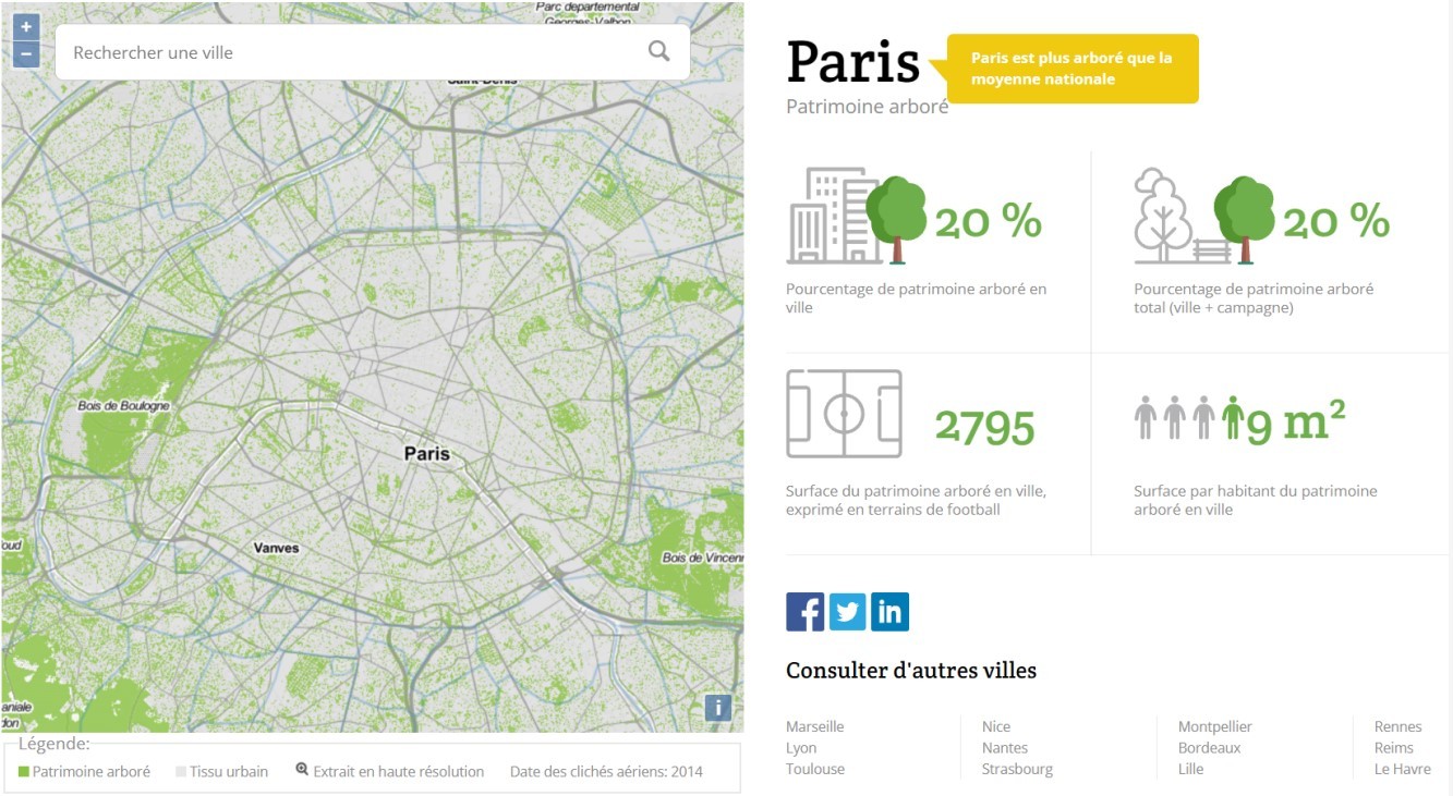
KERMAP
Urban Green Monitoring
French SME uses satellite imagery to help cities map and manage urban vegetation.

Greece
Property Rights Enforcement
Leverages satellite imagery to identify illegal structures and enforce construction permits.
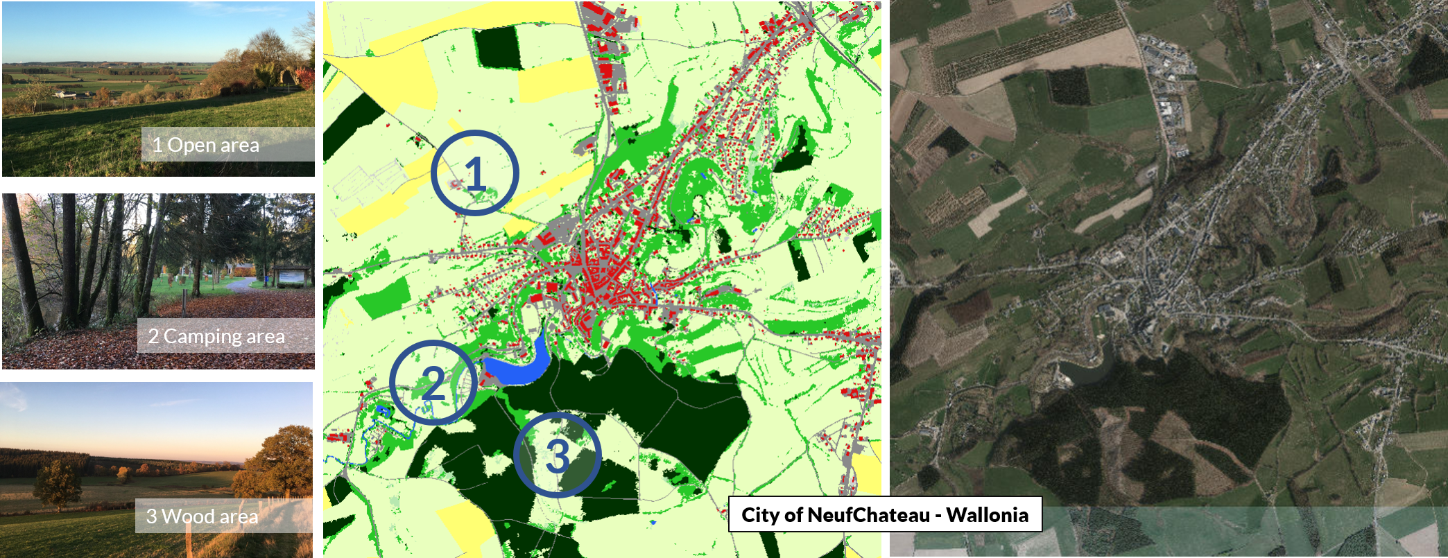
Wallonia
Land Cover Mapping
Creates comprehensive land cover and use maps using satellite and aerial imagery.
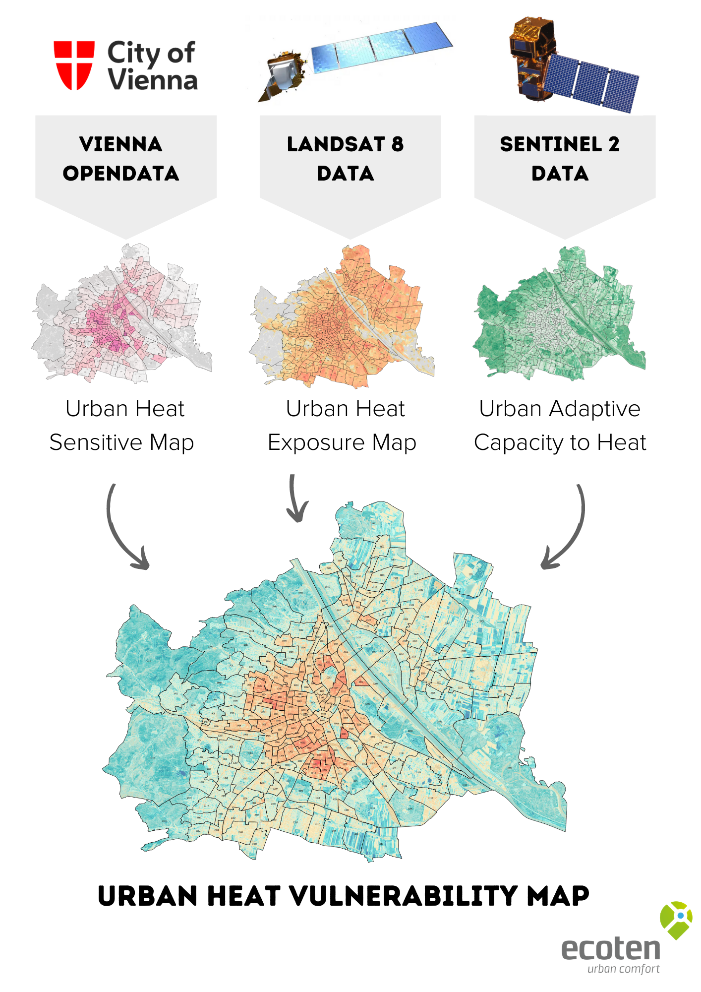
Vienna
Climate Urban Planning
Maps urban heat islands and implements cooling strategies like "Cool Streets".

Prague
Climate-Adapted Transport
Uses Copernicus data to assess and adapt public transport stops to climate change.
Sign up to access the full
Marketplace of Space-enabled solutions
Already signed up?
Log in